Home
Where to Stay List
Hike List
Hydrothermal Areas

Bookmark and Share


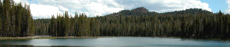
We hike the trails of Lassen National Park and Caribou Wilderness.  Our maps are free to you, the hiker.


member:

Sacramento Valley
Hiking Conference


Lassen Park Region hikes
 

Butte Lake trailheads

difficulty

hike name

best season

edition


short

Bathtub Lake loop

Jun-Oct

2008


easy

Cinder Cone semi-loop

Jun-Oct

2008


moderate

Prospect Peak up-and-back

Jul-Oct

2008


challenging

Fantastic Lava Beds loop

Jun-Oct

2008


uber

Horseshoe Lake loop

Aug-Oct

2008


uber

Jakey Lake loop

Aug-Oct

2008

option of Red Cinder; GPS best

Can I drink the water w/o treating it.? We do, except for creeks draining hydrothermal areas, and where cows graze in the National Forest. We think the risk is acceptable. Make your own decision.

Caribou Wilderness trailheads

difficulty

hike name

best season

edition


easy

Triangle Lake semi-loop

Jul-Oct

 2008


easy

Posey Lake loop

mid Aug-Oct

 2008


easy

Black Lake loop

Aug-Oct

 2008


moderate

Cone-to-Caribou shuttle

Aug-Oct

 2008

 requires shuttle

moderate

Hay-to-Caribou shuttle

mid Aug-Oct

 2008

 requires shuttle

moderate

North Caribou up-and-back

Aug-Oct

 2008

 gps recommended


Chester Area trailheads/Warner Valley

difficulty

hike name

best season

edition


short Boiling Springs Lake up-and-back Aug-Oct 2008  
easy Devils Kitchen in-and-back Aug-Oct 2008  
easy Drake Lake up-and-back Aug-Oct 2008  
easy Terminal Geyser in-and-back Aug-Oct 2008  
challenging Kings Creek loop mid Aug-Oct 2008 ford may be difficult until Sept
uber Kings Gorge loop mid Aug-Oct 2008 ford may be difficult until Sept


Chester Area trailheads/Juniper Lake

difficulty

hike name

best season

edition


short Crystal Lake up-and-back Aug-Oct 2008  
short Inspiration Point up-and-back Aug-Oct 2008  
easy Grassy Creek short loop Aug-Oct 2008  
easy Mount Harkness loop Aug-Oct 2008  
moderate Grassy Creek long loop Aug-Oct 2008  
challenging Rainbow Lake loop Aug-Oct 2008  


Heart Lake trailheads

difficulty

hike name

best season

edition


easy Heart Lake in-and-back Aug-Oct 2008  
moderate Glassburner Meadows shuttle Aug-Oct 2008  requires shuttle


Main Park Road trailheads/South area

difficulty

hike name

best season

edition


short Bumpass Hell in-and-back mid July-Oct 2008  
short Ridge Lakes up-and-back mid July-Oct 2008  
short Mill Creek Falls down-and-back July-Oct 2008  
moderate Lassen Peak up-and-back mid July-Oct 2008  may be snow patches
moderate Conard Meadows shuttle Aug-Oct 2008   requires shuttle
moderate Brokeoff Mountain up-and-back mid July-Oct 2008  
challenging Twin Meadows shuttle Aug-Oct 2008 also listed in Up. N. Fork River


Main Park Road trailheads/Central area

difficulty

hike name

best season

edition


short Kings Creek Falls down-and-back Aug-Oct 2008  
short Crumbaugh Lake in-and-back Aug-Oct 2008  
short Paradise Meadows up-and-back mid July-Oct 2008  
easy Cliff Lake up-and-back mid July-Oct 2008  
easy Sifford Lakes semi-loop Aug-Oct 2008  
easy Shadow Lake shuttle mid July-Oct 2008  requires shuttle
moderate Hat Creek Headwaters shuttle mid July-Oct 2008  requires shuttle
challenging Cluster Lakes loop Aug-Oct 2008  
challenging Grassy Swale loop mid Aug-Oct 2008 ford may be difficult until Sept


Main Park Road trailheads/North area

difficulty

hike name

best season

edition


short Lily Pond loop June-Oct 2008  
short Manzanita Lake loop June-Oct 2008  
easy Chaos Crater up-and-back July-Oct 2008  
moderate Manzanita Creek up-and-back July-Oct 2008  


Upper North Fork Feather River trailheads

difficulty

hike name

best season

edition


short Rice Creek up-and-back Aug-Oct 2008  
easy Willow Creek in-and-back Aug-Oct 2008  may want GPS
moderate Blue Lake loop July-Oct 2008  may want GPS
challenging Twin Meadows shuttle Aug-Oct 2008  also in Main Park Road/south
challenging Spencer Meadows semi-loop Aug-Oct 2008  


short = short hike of less than 6.0 mi-eq
easy = easy dayhike of 6.0-9.0 mi-eq
moderate = moderate dayhike of 9.0-13.5 mi-eq
challenging = challenging dayhike or easy overnight hike of 13.5 -20.25 mi-eq
uber = uber dayhike or overnight hike of over 20.25 mi-eq
---
mi-eq = hike’s miles + (hike’s elevation gain/500’)
in words:  each 500’ of elevation gain is the equivalent of one mile


Pacific Crest Trail

see
Sacramento Valley Hiking Conference
(see Collins Pine to Subway Cave for the PCT through Lassen Park)